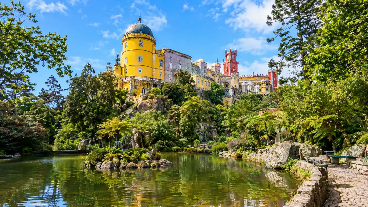
Pena Palace Gardens and Park: Lakes, Trails & Maps
Most visitors sprint straight up the ramp toward the yellow and red towers, snap forty selfies on the terrace, and leave without realizing they just bypassed an 85-hectare wonderland. Getting lost in the pena palace gardens was easily my favorite morning in Sintra. The mist hangs low between three-story tree ferns, moss smothers every granite boulder, and you can walk for twenty minutes along a dirt path without bumping into another soul. King Ferdinand II did not just build an eccentric castle here. He spent decades transforming an entire mountain ridge into an elaborate romantic forest, planting species from every continent he could reach by boat.
You could spend an entire afternoon wandering down through hidden ravines, stumbling across secluded stone benches, and tracking down quiet water reservoirs where ducks paddle in miniature stone castles. If you only see the palace rooms, you miss more than half the story. Here is what you need to know to navigate Parque da Pena, find the quietest trails, and track down the best vantage points across the Serra de Sintra.
Book your pena palace experience:
Navigating the Pena Palace Park and Map Essentials
The park is huge. It covers over 200 hectares of steep, jagged terrain, though the core visited area sits across roughly 85 hectares wrapping around the peaks. The elevation of Pena Palace sits at 529 meters above sea level. Cruz Alta, the highest peak in the Serra de Sintra, rises just past it to 544 meters. Because the trails climb and drop across massive granite ridges, walking here can tire you out quickly if you do not plan your route. You can grab a paper map of Pena Palace gardens at the ticket booths, or download the official offline PDF map on your phone before you arrive, which I strongly recommend because cell signal vanishes completely in the deeper gullies.
There are two primary ways to enter the grounds. Most travelers arrive through the main entrance near the road where the 434 tourist bus drops everyone off. That gate brings you right by the ticket counters and the gift shop. Another entrance, the Iron Gate (Porta de Ferro), sits further down near the road toward the Moorish Castle. Further along the western wall lies the quieter Porta da Rosa, which offers an easy approach if you want to visit the Countess of Edla Chalet before heading uphill.
Pro tip: Pick up the physical paper map from the turnstile staff right as you enter. Google Maps will fail you inside the deep fern valleys, and the trail color codes on the printed map match the painted wooden markers on the trail junctions.
To help you gauge the terrain and walking effort across the grounds, here is how the primary landmarks compare in walking distance and climbing effort from the main ticket entrance:
| Park Landmark | Distance from Main Gate | Average Walking Time | Elevation / Terrain |
|---|---|---|---|
| Palace Terraces | 650 meters | 12 to 15 minutes | Steep paved switchback path (+75m) |
| Valley of the Lakes | 450 meters | 8 to 10 minutes | Gradual downhill dirt and cobble path |
| Cruz Alta (High Cross) | 1,800 meters | 30 to 40 minutes | Mixed dirt trails with rocky, uphill steps |
| Chalet of the Countess of Edla | 1,400 meters | 20 to 25 minutes | Rolling gravel path through western woods |
| Pena Palace Stables | 1,100 meters | 15 to 18 minutes | Gentle dirt track near the lower perimeter |
If walking steep inclines sounds miserable or you have small kids in tow, a small green transfer bus runs between the main entrance gate and the palace terrace. It costs 3 euros for a round trip. It does not go anywhere else in the park, though, so exploring the lakes and outer trails still requires footwork.
Secret Trails: Valley of the Lakes, Chalet, and Stables
The Valley of the Lakes sits near the bottom of the park slope, fed by natural mountain springs that Ferdinand channeled into five interconnected ponds. It feels like stepping straight into a Grimm brothers fairy tale. Willow trees dip into the dark water, stone bridges cross quiet channels, and two small duck houses look like miniature medieval castles floating in the water. From the lower ponds, you can hear water trickling everywhere. A short path branches off toward the waterfall, tucked behind dense foliage about 150 meters from the lowest pool. The distance to the waterfall is tiny, yet half the people walking past never see the trailhead.
Past the ponds, you can wind your way west toward the Chalet of the Countess of Edla. Ferdinand built this private wooden cottage between 1869 and 1874 for his second wife, Elise Hensler. It was inspired by Swiss alpine chalets, decorated with cork bark around the doors and windows. The building burned down in an arson fire back in 1999, but a meticulous restoration brought it back to life with all its intricate wood carvings and surrounding botanical collections. The garden surrounding the chalet has its own distinct personality, packed with camellias and ferns gifted by friends of the royal couple.
Right near the chalet sit the Pena Palace stables. These historic stone buildings once held the royal carriage horses and riding stock. Today you can still book guided horseback riding tours through the Sintra woods or stop by to see the horses resting in their paddocks. If you want to check transport logistics from Sintra town before packing your walking shoes, take a look at our guide on how to get to Pena Palace.
- The Queen's Fern Valley: A secluded gully packed with massive tree ferns planted in 1843, creating a damp microclimate that stays 5 degrees cooler than the exposed castle terraces above.
- The Fountain of the Small Birds: A Moorish-style domed pavilion with vaulted tilework, designed as a resting spot where Ferdinand could listen to songbirds and echoing water.
- The Grotto of the Monk: A tiny stone hermitage hollowed out directly under a colossal granite boulder, used for quiet meditation long before the palace was constructed.
- The Royal Stables: Restored 19th-century stables situated on the western edge of the park where you can rent pony rides for young kids or book forest rides.
Walking between these spots takes patience. The paths are not laid out on a grid. Ferdinand deliberately designed them to curve and meander so visitors would constantly encounter unexpected viewpoints and dramatic rock formations. Take your time and wander down any narrow dirt track that looks intriguing.
Finding the Best View of Pena Palace: High Cross and Beyond
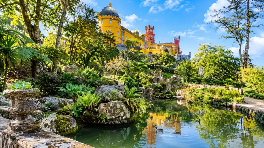
Everyone wants that postcard picture of the castle perched above the pines. You will not get it from the palace terrace itself. To get the best view of Pena Palace, you need to hike up to Cruz Alta (the High Cross). The trail leads you southwest through dense pine and eucalyptus forest, climbing steadily for about 25 minutes. At the top, 544 meters up, a carved stone cross marks the highest point in the entire Sintra mountain range. From here, you look across a wide canopy of treetops directly at the south facade of the palace. When the afternoon sun hits the yellow clock tower and the red minarets, the contrast against the green hills is incredible.
Another overlooked viewpoint is the St. Anthony viewpoint, sitting along a dirt track between the castle and the Valley of the Lakes. It gives you a dramatic low-angle perspective looking straight up at the monumental stone foundations and the Arches Yard. If you continue out toward the Chapel of St. Jerome, an old stone hermitage perched on a steep granite cliff, you get sweeping views that stretch past the town of Sintra and out to the Atlantic coastline near Cabo da Roca on clear days.
Note: Fog can roll in from the ocean in less than 15 minutes. If you reach Cruz Alta and find yourself surrounded by a white wall of mist, sit on the granite boulders and wait 10 or 15 minutes. Sintra winds shift constantly, and the palace often peeks back out through gaps in the cloud cover.
The Temple of Columns is another spot worth finding. Ferdinand erected it on the site of an old chapel, placing twelve granite columns under a small dome where he could gaze directly across the gap at the palace towers. It offers a much closer perspective than Cruz Alta, making it ideal for phone cameras without long zoom lenses.
Book your pena palace experience:
Plants, Flora, and the Historic Forest of Pena Palace
Before Ferdinand bought the ruins of the Hieronymite monastery in 1838, this entire mountain ridge was barren rock, scoured bare by centuries of grazing, logging, and Atlantic storms. The King imported over 500 different tree species from across the globe. He ordered North American sequoias, Western red cedars, Japanese cryptomeria, Australian eucalyptus, and Chinese ginkgo trees. He combined them with native Mediterranean oaks, maritime pines, and arbutus shrubs to create a dense, layered canopy.
The microclimate in Sintra makes this botanical madness possible. Moisture blows off the Atlantic Ocean, hits the steep granite mountain, and condenses into a perpetual envelope of fog and light drizzle. Because of this constant humidity, exotic plants that would wither under the blazing sun of Lisbon thrive here without artificial irrigation. The Australian tree ferns in the Feteira da Rainha have grown so tall their fronds form a solid canopy twenty feet above your head, filtering the light into a surreal green twilight.
Scattered throughout the woods are tiny historic structures built for fun, reflection, or shelter. You will find small ornamental greenhouses, natural springs fitted with carved marble spouts, and quiet granite benches wedged directly into natural fissures. The landscape was treated as an outdoor extension of the palace itself, blending romantic artifice with raw nature. You can read more about the king's artistic vision and architecture in our breakdown of Pena Palace history and architecture.
Practical Visiting Tips: Tickets, Timing, and Walking Routes
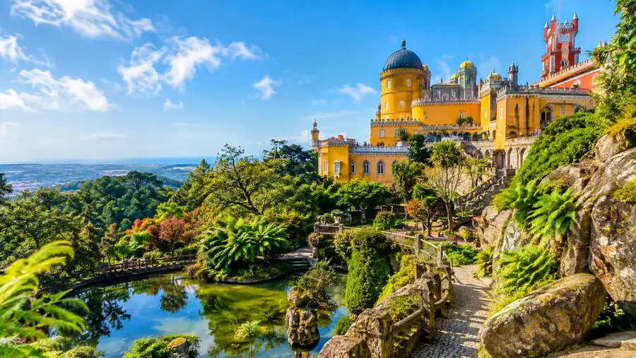
One of the best practical tips I can give you is that you do not need an interior palace ticket to enjoy the estate. The "Park Only" ticket grants full access to all 85 hectares of grounds, the Valley of the Lakes, Cruz Alta, the Countess Chalet, and the exterior terraces of the palace itself where you can walk under the famous Triton arch. If the interior timed slots are sold out for the day, buy a park ticket and skip the crowded rooms entirely. If you want to know all the ticket prices and booking nuances, read our detailed Pena Palace tickets guide.
How long do you need at Pena Palace gardens? Honestly, you need at least two hours for a quick loop, but three to four hours is far better if you plan to hike out to Cruz Alta and explore the Chalet of the Countess of Edla. Rushing through this terrain is miserable because of the steep climbs. Wear sturdy sneakers or light hiking shoes. The cobblestones and granite steps get slick as ice when the Sintra fog coats them with moisture.
- Morning entry: Enter right at 9:00 AM when the gates open. The vast majority of tourists queue immediately for the palace interior, leaving the lakes, fern valleys, and hiking trails completely deserted for your first hour.
- Water and snacks: Food options inside the park are limited to two small cafes with long lines and inflated prices. Pack a water bottle and a sandwich in your daypack so you do not have to hike back uphill just to grab lunch.
- Pacing the climb: Walk downhill to the Valley of the Lakes first, then take the gradual western trail toward the Chalet, and finish with the uphill climb to the palace so you are not tackling the steepest slopes in the midday heat.
- Ticketing logistics: You cannot leave the park grounds and re-enter on the same ticket. Once you scan through the turnstile, plan to stay inside until you are ready to head back down to Sintra town.
Temperatures up on the mountain can easily sit 5 to 7 degrees Celsius lower than downtown Lisbon, and the wind near Cruz Alta bites hard. Even on a warm summer day, throw a light windbreaker or an extra layer into your bag before you leave your hotel.
Frequently Asked Questions about pena palace gardens
Can you leave and come back to Pena Palace gardens on the same ticket?
No. Tickets only allow a single scan at the entrance turnstiles. Once you exit the gates back onto the public road, you cannot re-enter without purchasing a new ticket, so make sure you see everything you want before walking out.
Can you visit the Pena Palace gardens without entering the palace interior?
Yes. You can purchase a "Park Only" ticket for around 10 euros. This ticket includes complete access to all 85 hectares of trails, the Valley of the Lakes, the Chalet of the Countess of Edla, Cruz Alta, and the outdoor terraces of the castle.
How hard is the hike up to Cruz Alta from the palace?
The trail to Cruz Alta is moderately steep on a mix of dirt paths and stone steps. It takes about 20 to 30 minutes from the palace terrace, covering roughly 1.5 kilometers of steady uphill walking. It is manageable for anyone with basic fitness, but wear supportive footwear.
Are the Pena Palace gardens accessible for strollers or wheelchairs?
Most of the secondary park trails, including Cruz Alta and the fern valleys, consist of uneven dirt, exposed tree roots, and steep granite steps that are not wheelchair or stroller friendly. However, paved pathways connect the main entrance to the palace terrace, and a low-floor transfer bus is available for those with reduced mobility.
Where is the best view of Pena Palace inside the park?
Cruz Alta offers the iconic, elevated panoramic view across the tree canopy. For a closer perspective looking directly at the palace facade, visit the Temple of Columns or the viewpoint near St. Catherine's Heights.
Quick Reference
- Total park size: 85 hectares of core trails (over 200 total)
- Highest point: Cruz Alta at 544 meters altitude
- Recommended visit duration: 2.5 to 4 hours
- Footwear: Hiking shoes or grippy sneakers essential
- Best quiet spot: Feteira da Rainha (Queen's Fern Valley)
Book your pena palace experience:
The Bottom Line
Do not treat the grounds of Pena as an afterthought or a quick path to get to the gift shop. King Ferdinand's true genius was not just picking eccentric paint colors for his castle towers. He built an entire living, breathing ecosystem on an Atlantic mountaintop that feels more like an enchanted wilderness than a traditional manicured European estate. Skip the crowded interior queues, put away your phone's GPS, take the fork in the path that everyone else ignores, and let yourself get lost in the woods for an afternoon.
Read more about pena palace.